Russian Navy Russian Naval Air Transport / Naval Aviation
This short text does not claim to be complete or exact, it is just an attempt to collect and consolidate sparse notes about the Rus Navy way to Morse. I did examined my own logs, browse some Navy and Defense websites, mainly from Russia, N&O columns / Spooks newsletters, public available sources and public sites/forums on the web (later reported). You have to know that this document is always-under-construction and may be outdated, incomplete or even wrong.Comments are welcome.
The Russian Navy (Voenno-Morskoj Flot Rossii, lit. Military-Maritime Fleet of the Russian Federation) is the naval arm of the Russian military. The present Russian Navy was formed in January 1992, succeeding the Navy of the Commonwealth of Independent States, which had itself succeeded the Soviet Navy following the dissolution of the Soviet Union in December 1991.
Russian Navy is now probably the last fleet of the world that uses on such a large scale CW. Russians know that not everything can be converted into dollars in the pursuit of modernity and profit, and traditional communication systems such as Telegraphy still have their good sides, like simplicity, reliability, resistance to interference, and finally tradition.
The Russian Navy possesses the vast majority of the former Soviet naval forces, and currently comprises the Northern Fleet, the Russian Pacific Fleet, the Russian Black Sea Fleet, the Russian Baltic Fleet, the Russian Caspian Flotilla other than the Naval Aviation, and the coastal troops (consisting of the naval infantry and the coastal missile and artillery troops.

The Northern Fleet is armed with nuclear-powered and torpedo submarines, missile-carrying and anti-submarine aircrafts as well as rocket-powered, aircraft-carriers and anti-submarine ships. It established as a modern formation in 1933, is headquartered at Severomorsk and spread around various bases in the greater Murmansk area. This is the main fleet of the Russian Navy.
The Russian Pacific Ocean Fleet, established on 10 May 1731 and headquartered in Vladivostok, is another operational-strategic unit of the Russian Navy. In order to fulfill its military missions, the Pacific Ocean Fleet is armed with strategic rocket-powered submarine cruisers, multipurpose nuclear-powered and diesel submarines, surface ships for ocean and sea-zone maneuvers, marine rocket-carrying/anti-submarine and fighting aircrafts along with land forces and some land forces and coastal defense divisions.
The Black Sea Fleet ( BSF) is an operational-strategic association of the Navy of Russia in the Black Sea with the main base situated in Sevastopol. The Russian Black Sea Fleet, as a part of the Navy, is a means of ensuring Russia's military security in the south. To perform the tasks the Black Sea Fleet has in its composition diesel-driven submarines, surface ships for operations in oceanic and near-sea areas, naval missile-carrying aviation, anti-submarine and fighter aviation, units of coastal troops.
Currently, the main tasks of Russian Black Sea Fleet are as follows:
- Protection of the economic zone and areas of productive activities, suppression of illegal productive activities;
- ensuring safety of navigation;
- implementation of foreign policy actions of the Government in economically important areas of the oceans (visits, routine entries, joint exercises, actions as a part of peacekeeping forces, etc.)
The Baltic Fleet is an operational-strategic unit of the Russian Navy at the Baltic Sea. Main bases are Baltiysk (Kaliningrad region) and Kronshtadt (Leningrad region). They consist of surface ships division, diesel submarines brigade, service boats and search-and-rescue ships formations, the Air forces, coastal defense troops, rear technical and special security units.
The Caspian Flotilla, established on 4 November 1722, is based in Astrakhan and Makhachkala with its headquarters in Astrakhan.
(reported) CW frequencies
(The main frequencies in use are 8345.0 kHz and 12464.0 kHz, although there are hundreds listed that have been used by the Russian Navy. They are all in CW)
583 3192 3338.5 4048 4079 4376.5 4478 4851 5019 5135.5 5213 5224 5343 5400.5 5775
6308 6345 6769 6827 6948 7015 7467 7566 7632 7664 7749 7763 7861 8136 8345 8816 8794
9068.5 9069.5 9145 9192 9373 9988 10203 10543 11000 11155 12464 13044 13636 13975
14556 15812 17468 17615 19201 19304 21438
6308 6345 6769 6827 6948 7015 7467 7566 7632 7664 7749 7763 7861 8136 8345 8816 8794
9068.5 9069.5 9145 9192 9373 9988 10203 10543 11000 11155 12464 13044 13636 13975
14556 15812 17468 17615 19201 19304 21438
(known) Callsigns:
RIW Navy Headquarters, Moscow
Headquarters in Moscow is a very active station maintaining liaison with ships of all fleets, often at great distances from the so-called 'Dalnymi pohodami' or Russian naval expeditions to distant sea, and squadrons.
HQ Moscow uses multiple broadcasting centers around Moscow, hence uses many callsigns, RIW is most commonly used, but they are also characters such as RAA (perhaps it is the commander's call sign WMF, or main headquarters WMF), and often RJE56 - it is broadcasting center in Manikinie near Moscow. Sign RJE56 is used only when XQ or communication between stations on land specifically allocated for this purpose frequencies. In the past, were also used in other characters, such as RMR.
- Northern Fleet
RIT Severomorsk, Northern Fleet Headquarter
RJD56 Murmansk, Naval Base
RJD99 Severodvinsk, Naval Base
RIT main frequency 11155.0
- Baltic Fleet
RMP Kaliningrad, Baltic Fleet Headquarter
RJC66 ST. Petersbourg, Comm. Center
RJD69 Baltiysk, Naval Base
RJD85 Kronstadt, Naval Base
- Black Sea Fleet
RCV Sevastopol, Black Sea Fleet Heardquarter
RJE65 Istanbul, Naval Base
- Caspian Flotilla
RKN Astrakhan, Caspian Flotilla Heardquarter
RJD52 Caspiysk, Naval base
- Pacific Fleet
RJS Vladivostok, Pacific Fleet Heardquarter
RCC Petropavlovsk Kamchatskiy, Naval Base
RTS Magadan, Naval Base (mostly abandoned)
Frequencies of RJS: 4048, 10203, 13636, 7632 kHz
some other known stations
RAB99 KHABAROVSK (Vladimirovka)
RJE56 MOSCOW (MANIKINO)
RJH25 KIRGHIZISTAN
RJH63 KRASNODAR (MARTANSKAYA)
RJH66 CHALDOVAR, KZ (KARA-BALTA)
RJH69 CVILEIKA, BLR
RJH77 VILEIKA, BLR
RJH90 NIZHNY NOVGOROD
RJH99 DRUZHNIY
some other known stations
RAB99 KHABAROVSK (Vladimirovka)
RJE56 MOSCOW (MANIKINO)
RJH25 KIRGHIZISTAN
RJH63 KRASNODAR (MARTANSKAYA)
RJH66 CHALDOVAR, KZ (KARA-BALTA)
RJH69 CVILEIKA, BLR
RJH77 VILEIKA, BLR
RJH90 NIZHNY NOVGOROD
RJH99 DRUZHNIY
Notes: (Derived from Fritz’ excellent website at http://www.astrosol.ch/index.html)
- RIW is a function, not a location. There is evidence the RIW operators use several callsigns from the same desk. In certain cases RIW becomes RJE56. In normal traffic with any ship RIW suddenly becomes RAA for an hour just to continue as RIW again.
- RIT uses the collective callsigns RLO, RKZ, RKS and others for its fleet or for a certain task force.
- RMP uses the collective callsigns REO, RMU, RKZ and others for its fleet or for a certain task force.
- RCV uses the collective callsigns RKZ, RKS, RJV, RIP90, RBE86, RGX94 and others for its fleet or for a certain task force.
(known) Callsigns used by the ships
--> Read more info about the Morse used by Russian Navy
Ships positition can be derived from the Code FM-13-X-SHIP (or shortly FM-13), the ships synoptic code. It is comprised of 23 groups of symbolic letters representing meteorological and oceanographic elements, report identification and ship location data.
- Ship current position is coded in the Ships Synoptic Code Section 0:
... 99LaLaLa QcLoLoLoLo
99, Data on Position Follow.
LaLaLa, Latitude in degrees and tenths of a degree.Always coded with three digits, the first two digits are actual degrees, the last digit for tenths of a degree.
Qc, Quadrant of the globe (specify whether the latitude is north or south and the longitude east or west).If north of the equator (north latitude), Qc is coded as 1 when east of the Greenwich Meridian (east longitude), or as 7 when west of the Greenwich meridian. If south of the equator (south latitude), Qc is coded as 3 when east of the Greenwich meridian, or as 5 when west of the Greenwich meridian.
LoLoLoLo, Longitude in degrees and tenths of a degree. Always coded with four digits, with the leading (hundreds) figure coded as 0 or 1. The first three digits are actual degrees, the last digit for tenths of a degree.
- the ship movement data is coded in Section 2:
222DsVs ...
222, indicator
Ds, true ship’s course made good during the three hours preceeding the time of observation:
0 Ship hove to
1 NE
2 E
3 SE
4 S
5 SW
6 W
7 NW
8 N
9 Unknown
/ Not reported
Vs, Ship’s average speed, in knots, made good during the three hours preceeding the time of observation.
0 0 knot
1 1 to 5 knots
2 6 to 10 knots
3 11 to 15 knots
4 16 to 20 knots
5 21 to 25 knots
6 26 to 30 knots
7 31 to 35 knots
8 36 to 40 knots
9 Over 40 knots
/ Not reported
So, looking at the following heard message:
VVV RJD99 DE RBC89 QSA? QTC
RBC89 572 9 5 0955 572 = FOR RJD90 RJH74 =
050?? 99662 10345 41/96 9230? 00050 40000 52020
70222 89/// 22232 00030 20202 232// 40302 88000
05016 = + RBC89
the ship RBC89 (calling ship RJD99) at that time was at 66.2N 34.5E , heading SE @ 6-10kts: the position of RBC89 is decoded from 99662 10345, with the heading/speed 22232:

You can also do a quick check of MarineTraffic.com to see what it shows where a ship had reported its position...
other CW messages and Q-codes
other CW messages are QTC and QSA requests such as:
VVV RCV DE RFH70 QSA?
RCV DE RFH71 QSA 3 K
VVV RJD99 DE RBC89 QSA? QTC
RBC89 186 ?? 5 0730 186 = FOR RJD90 RJH74 = 05021 99662 10362 41/96 92207 00040 49980 54000 748?4 89/// 22272 00030 20202 319// 40402 88000 05016 = + RBC89
The following message is a radiocheck
RCV DE RFH71 QSA 3 K
sent by ship Novocherkassk, Amphibious Landing (callsign RFH71) to HQ base of BSF in Sevastopol (RCV)
QWH I start send on frequency
QWH 9700/rptd = 12056/rptd will send on 9700, alternatively on 12056
QWH 9700/8536 = 12056/12572 the link will run with two parallel frequencies
QYR I start working on 81Baud RTTY
QYS I start working on duplex radiotelephony
QYT4 I start use MS-5 system
QYT4 QMO Adjust your MS-5 system
QSX 8440/rptd = 12414/rptd I will listen on 8440, alternatively on 12414QLS Use (upper) alternative frequency or Change frequency!
QRS Send slower
so that a trasmission such as:
RMRV OK QYT 4 QWH 16680 K
means that ship RMRV will start to transmit in MS-5 multiplex mode on 16680.0 KHz
I recently found a good site by Tony Roper (planesandstuff) reporting an updated list of Russian Navy Callsigns that have been picked up on HF over the last few years. Where callsigns have been positively tied up to certain ships or
stations, this is also shown.
As Tony says, "it's an incomplete list and will be
updated as new callsigns are picked up" anyway that's a good work and it is a list of great help for listeners who love that branch of HF trasmissions.The callsigns address is: http://planesandstuff.wordpress.com/russian-navy-callsigns/
Quite a few ships have been tied up to the callsigns through their
reports. This is achieved from the Russian Navy themselves as
they publish news items everyday on the internet, especially when ships
arrive at certain locations. I'd suggest also the use of a few other websites including Shipspotting.com and Bosphorus Navy News
--> Read more info about the Morse used by Russian Navy
ships tracking (listening to ships weather reports)
Russian Navy ships send weather reports every 6 hours for their current location. They use the standard observation method as described by NOAA in their observation handbook, and within this message format there is a Lat/Long position report for where the observation took place. This means you are able to track their positions.Ships positition can be derived from the Code FM-13-X-SHIP (or shortly FM-13), the ships synoptic code. It is comprised of 23 groups of symbolic letters representing meteorological and oceanographic elements, report identification and ship location data.
- Ship current position is coded in the Ships Synoptic Code Section 0:
... 99LaLaLa QcLoLoLoLo
99, Data on Position Follow.
LaLaLa, Latitude in degrees and tenths of a degree.Always coded with three digits, the first two digits are actual degrees, the last digit for tenths of a degree.
Qc, Quadrant of the globe (specify whether the latitude is north or south and the longitude east or west).If north of the equator (north latitude), Qc is coded as 1 when east of the Greenwich Meridian (east longitude), or as 7 when west of the Greenwich meridian. If south of the equator (south latitude), Qc is coded as 3 when east of the Greenwich meridian, or as 5 when west of the Greenwich meridian.
LoLoLoLo, Longitude in degrees and tenths of a degree. Always coded with four digits, with the leading (hundreds) figure coded as 0 or 1. The first three digits are actual degrees, the last digit for tenths of a degree.
- the ship movement data is coded in Section 2:
222DsVs ...
222, indicator
Ds, true ship’s course made good during the three hours preceeding the time of observation:
0 Ship hove to
1 NE
2 E
3 SE
4 S
5 SW
6 W
7 NW
8 N
9 Unknown
/ Not reported
Vs, Ship’s average speed, in knots, made good during the three hours preceeding the time of observation.
0 0 knot
1 1 to 5 knots
2 6 to 10 knots
3 11 to 15 knots
4 16 to 20 knots
5 21 to 25 knots
6 26 to 30 knots
7 31 to 35 knots
8 36 to 40 knots
9 Over 40 knots
/ Not reported
So, looking at the following heard message:
VVV RJD99 DE RBC89 QSA? QTC
RBC89 572 9 5 0955 572 = FOR RJD90 RJH74 =
050?? 99662 10345 41/96 9230? 00050 40000 52020
70222 89/// 22232 00030 20202 232// 40302 88000
05016 = + RBC89
the ship RBC89 (calling ship RJD99) at that time was at 66.2N 34.5E , heading SE @ 6-10kts: the position of RBC89 is decoded from 99662 10345, with the heading/speed 22232:
You can also do a quick check of MarineTraffic.com to see what it shows where a ship had reported its position...
other CW messages and Q-codes
other CW messages are QTC and QSA requests such as:
VVV RCV DE RFH70 QSA?
RCV DE RFH71 QSA 3 K
VVV RJD99 DE RBC89 QSA? QTC
RBC89 186 ?? 5 0730 186 = FOR RJD90 RJH74 = 05021 99662 10362 41/96 92207 00040 49980 54000 748?4 89/// 22272 00030 20202 319// 40402 88000 05016 = + RBC89
The following message is a radiocheck
RCV DE RFH71 QSA 3 K
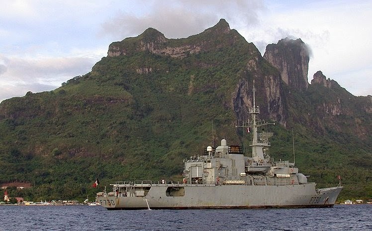
sent by ship Novocherkassk, Amphibious Landing (callsign RFH71) to HQ base of BSF in Sevastopol (RCV)
 |
| Novocherkassk |
Other than the Q-codes meanings assigned by ITU, the following codes are used by the Russian Military:
QWH I start send on frequency
QWH 9700/rptd = 12056/rptd will send on 9700, alternatively on 12056
QWH 9700/8536 = 12056/12572 the link will run with two parallel frequencies
QYR I start working on 81Baud RTTY
QYS I start working on duplex radiotelephony
QYT4 I start use MS-5 system
QYT4 QMO Adjust your MS-5 system
QSX 8440/rptd = 12414/rptd I will listen on 8440, alternatively on 12414QLS Use (upper) alternative frequency or Change frequency!
QRS Send slower
so that a trasmission such as:
RMRV OK QYT 4 QWH 16680 K
means that ship RMRV will start to transmit in MS-5 multiplex mode on 16680.0 KHz
Russian Navy Russian Naval Air Transport / Naval Aviation
Sources and References:


.jpg)